AI query
WellStrata
Oil & gas data, answered in plain English
WellStrata combines QC-scored regulatory data with an AI query interface across six onshore states and 3.3M+ wells. Ask questions in plain English, explore wells on an interactive map, benchmark operators, build type curves, and pull it all through a clean REST API — no SQL and no enterprise price tag.
Capabilities
Everything WellStrata does
AI Query Interface
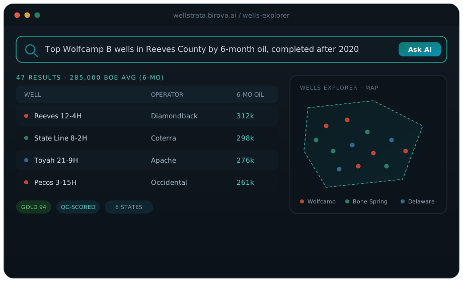
Ask questions in plain English — type "top Wolfcamp B wells in Reeves County by 6-month oil, completed after 2020" and get a ranked table in seconds. No SQL, no filters, no learning curve.
Wells Explorer
A full-screen interactive Mapbox map with formation-colored well dots across six states. Draw a polygon to instantly select every well inside an acreage block, then filter by state, formation, county, and operator.
QC-Scored Data
Every record carries a 0–100 quality score across Gold, Silver, Bronze, and Flagged bands — with canonical operator names, coordinate validation, and anomaly detection, so you know exactly how much to trust each data point.
Operator Benchmarking
Rank every operator in a basin by IP30, cumulative oil, well count, and lateral length, with color-coded quartile rankings and drill-down into any operator's formation mix and top wells.
Type Curve Builder
Generate P10/P50/P90 production decline curves for any formation, operator, county, and vintage. Overlay curves to compare scenarios and export rates at every month-on-production as CSV.
Chemicals Explorer
FracFocus data decoded: compare operators by water intensity, explore every ingredient by CAS number with PubChem links, and track chemical adoption trends across any basin.
Document Intelligence
AI extracts completion parameters — stages, proppant, frac fluid, perforation intervals — from regulatory PDFs (Texas W-2, New Mexico C-102) that never appear in any bulk state download.
REST API & Monthly Refresh
A clean, documented API with a full OpenAPI spec, refreshed monthly from TX, OK, ND, NM, CO, and WY — with data-freshness metadata on every response so you always know what you're looking at.
How it works
From input to answer
Data ingested from state agencies
Production, wellbore, and completion filings are pulled every month from TX RRC, ND DMR, NM OCD, CO ECMC, WY WOGCC, and OK OCC.
AI extracts from regulatory PDFs
Completion reports (W-2, C-102) are parsed for stages, proppant, fluid type, and perforation intervals that aren't in bulk downloads.
QC pipeline scores every record
Canonical names, coordinate validation, and anomaly detection produce a composite quality score. Raw and QC'd data are both preserved.
You query in plain English
The AI translates your question into a structured query and returns a table, chart, or natural-language summary.
Ready to build with WellStrata?
Request API access or talk to our team about how WellStrata fits into your upstream workflows.